Best Hiking Trails Near Missoula: From Easy Strolls to Mountain Summits |
7 incredible trails for every skill level—all within 45 minutes of downtown |
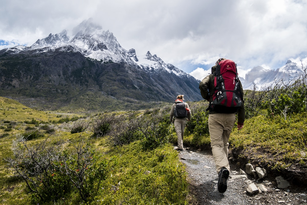 |
Hiking trails near Missoula range from riverside strolls perfect for families to lung-busting summit climbs that reward you with 360° views of the Bitterroot, Rattlesnake, and Sapphire mountain ranges.
With over 50 trailheads within 30 minutes of downtown, Missoula is a hiker's paradise—whether you're seeking wildflower meadows, alpine lakes, or just a quick escape into the woods after work.
This guide covers the best trails for every skill level, from beginner-friendly to expert-only, all accessible from the Garden City.
🥾 Easy Trails (1–3 miles, minimal elevation gain)
1. Kim Williams Trail Distance: 2–5 miles (out-and-back, choose your turnaround) Difficulty: Easy, flat, paved Trailhead: Near University of Montana or Bess Reed Park
Why we love it: The Kim Williams Trail follows the Clark Fork River through Hellgate Canyon and is perfect for walking, jogging, or biking.
Dog-friendly, stroller-friendly, and accessible year-round.
Watch for ospreys and blue herons along the river.
2. Rattlesnake Creek Trail Distance: 3 miles (out-and-back) Difficulty: Easy, gentle incline Trailhead: Sawmill Gulch Trailhead (10 min from downtown)
Why we love it: Shaded forest trail along Rattlesnake Creek with footbridges, wildflowers (June–July), and options to extend into the Rattlesnake Wilderness.
Great for kids and dogs.
⛰️ Moderate Trails (3–6 miles, 500–1,500 ft elevation gain)
3. Mount Sentinel "M" Trail Distance: 3.2 miles (round trip) Difficulty: Moderate, steep switchbacks Trailhead: University of Montana campus Elevation gain: 620 feet
Why we love it: Missoula's most iconic hike.
The giant "M" is visible from downtown, and the views from the top overlook the entire valley, the Clark Fork River, and the University.
Go at sunrise or sunset for the best light.
Note: it's a workout—bring water.
4. Blue Mountain Recreation Area Loop Distance: 5 miles (loop) Difficulty: Moderate, rolling hills Trailhead: Blue Mountain Recreation Area (15 min from downtown)
Why we love it: Forested loop with meadows, mountain views, and wildflowers in summer.
Mountain bikers and hikers share the trail.
Less crowded than Pattee Canyon or the "M."
🏔️ Advanced Trails (6+ miles, 1,500+ ft elevation gain)
5. Pattee Canyon to Crazy Canyon Loop Distance: 6.5 miles (loop) Difficulty: Moderate to difficult Trailhead: Pattee Canyon Trailhead (15 min from downtown) Elevation gain: 1,200 feet
Why we love it: Popular with Missoula locals who want a solid workout without driving far.
Panoramic views of the Missoula Valley, Mount Jumbo, and the Sapphire Mountains.
Expect afternoon heat in summer—start early.
6. Lolo Peak Trail Distance: 9 miles (round trip) Difficulty: Difficult, steep and rocky Trailhead: Lolo Pass area (45 min southwest of Missoula) Elevation gain: 3,200 feet Summit elevation: 9,096 feet
Why we love it: One of the most rewarding summit hikes near Missoula.
Above treeline views, alpine meadows, and wildflowers.
Snow lingers until late June—check conditions before heading up.
Bring layers; it's cold and windy at the top.
7. St. Mary's Peak (Bitterroot Range) Distance: 11 miles (round trip) Difficulty: Difficult Trailhead: St. Mary's Trailhead (1 hour south of Missoula, near Stevensville) Elevation gain: 3,800 feet Summit elevation: 10,023 feet
Why we love it: The highest peak in the Bitterroot Range accessible by trail.
Stunning 360° views, high-alpine terrain, and wildflowers.
This is a full-day commitment—start at dawn and bring plenty of water and snacks.
How to Stay Safe Hiking Near Missoula, Montana
Montana trails come with unique risks: bear encounters (both black bears and grizzlies in some areas), sudden weather changes, and afternoon thunderstorms in summer.
Always carry bear spray on any trail in the Rattlesnake Wilderness, Lolo Peak area, or Bitterroot Range—REI in Missoula rents canisters if you don't want to buy.
Hike in groups when possible and make noise on blind corners.
Check weather forecasts before heading out; thunderstorms build fast in the mountains, especially July–August.
Trails like Lolo Peak and St. Mary's Peak can have snow into late June, so bring microspikes or check recent trip reports on AllTrails.
And always tell someone your plans—cell service is spotty or nonexistent on most Missoula-area trails. |